
REGARDS Project: Using high-resolution satellite data to evaluate linkages
between blood pressure, land cover/land use, and temperature
A national cohort study by the University of Alabama at Birmingham School of Public Health
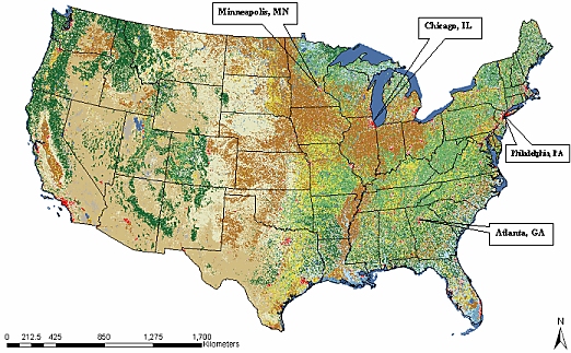
With urbanization, an increase of hypertension has been observed. High blood pressure is an independent risk factor for heart disease, stroke, and kidney failure. Research studies in Africa that have compared blood pressure rates among persons living in rural, semi-urban, and urban locations are showing a correlation between urban dwellers and elevated blood pressure (Agyemang et al 2005), (Van Rooyen 2000), (Opie 2005), (Schutte 2004), (Seedat 2005), (Cooper 2003). Few studies in the United States have examined regional and urbanization differences in hypertension (Obisesan 1999), (Gillum 1996). Our proposal is to examine the relationship between living environment defined as urban, suburban, and rural and day/night (maximum versus minimum) land surface temperature with blood pressure in selected regions from the Reasons for Geographic and Racial Differences in Stroke (REGARDS) cohort.
Hypotheses:
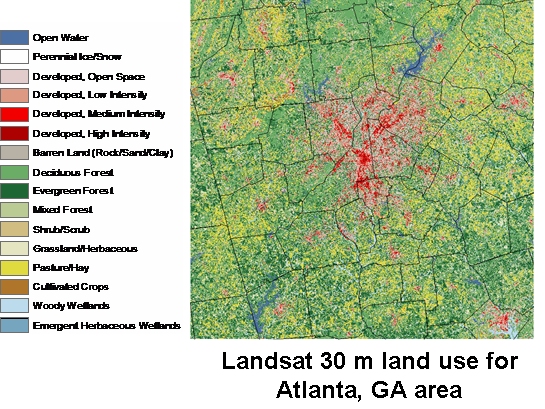
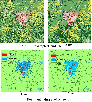
Distribution of Urban, Suburban, and Rural Living Environments

Summary/conclusion: Presentations & Publications Using Remotely Sensed Data and GIS Tools to Characterize Living Environments for Evaluation with Blood Pressure Data abstact |
Technical Contact: Dr. Doug Rickman (Douglas.L.Rickman@nasa.gov)
Responsible Official: Dr. James L. Smoot (James.L.Smoot@nasa.gov)
Page Curator: Diane Samuelson (diane.samuelson@nasa.gov)