NASA Land Information System (LIS): A Primer
Posted on: July 1, 2014
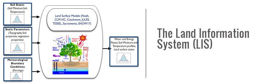
This module serves as a primer on the NASA Land Information System (LIS) software framework, SPoRT’s real-time configuration of the Noah land surface model within LIS, and how one can view LIS output for situational awareness applications. Input static fields and atmospheric forcing datasets are described, including the use of real-time MODIS Green Vegetation Fraction in place of a climatological vegetation depiction. The training module is approximately 20 minutes in length and contains a few questions to demonstrate knowledge gained. Detailed applications of LIS in an operational environment is covered in a subsequent module.
Author (s): Jonathan Case
Language: English
Publication Date: July 1, 2014
Skill Level: 1 (Requires basic scientific literacy)
Prerequisites: none
Completion Time: 21 minutes
Includes Audio: Yes
Required Plugins: Please see ‘Install Manual’ document below
Recommended Browser: Safari
Categories: Hydrology/Flooding, Modeling Data Assimilation