AMSR GMI 37 GHz Microwave Product
Posted on: 14 March 2017
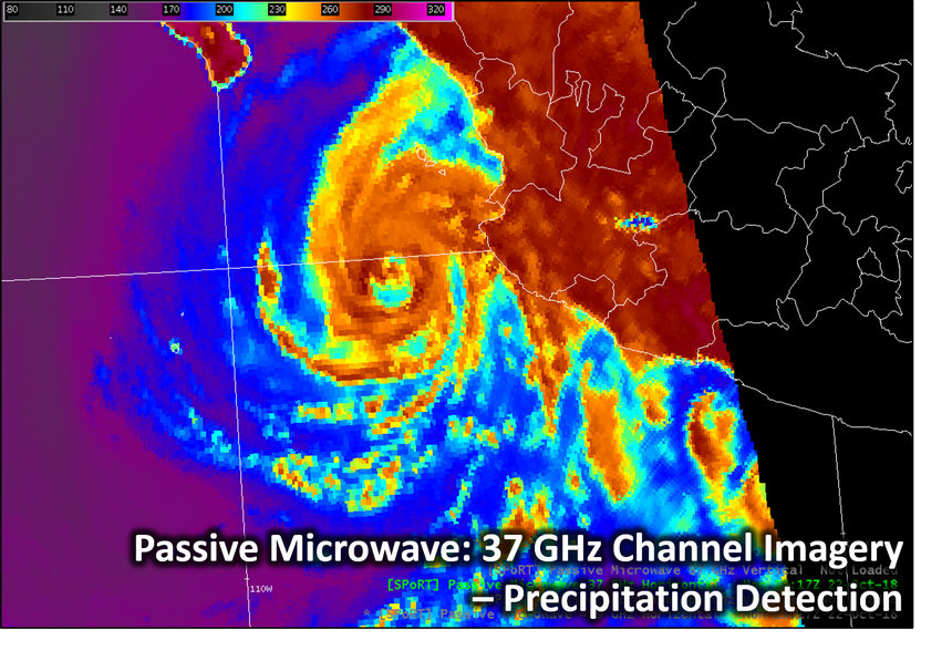
This item will show an application of the 37 GHz passive microwave channel, using GCOM's AMSR2 instrument as our data source, as well as case examples using a recent hurricane and offshore system to illustrate this instrument. The purpose of these data are to help sense liquid precipitation and storm offshore structure. In this Brief, we will discuss the difference between the vertical and horizontal polarizations of the 37GHz channels, and which might be most useful. We will also use these datasets to discriminate between the sea surface, rain, and convective activity in our examples. Also, we will use the 37 GHz data to estimate the location of the Low Level Convective Center in a tropical cyclone, as if we were doing so to use in the Dvorak intensity estimate. In our examples, we will be using data from GCOM-1's AMSR2 instrument, the Advanced Microwave Scanning Radiometer, and GMI, the GPM Microwave Imager. AMSR2 and GMI have relatively high spatial resolutions at 37 GHz, at roughly 7 by 12 km, and 15 by 9 km, respectively.
Contact Time: 5-8 minutes (micro-lesson)Date of Event
Date of Event: 23 October 2018
Region: Gulf of Mexico, Florida Offshore
Author (s): Anita LeRoy, Laurie Nave
Product(s): AMSR2/GMI 37 GHz Passive Microwave Product
Application Area: Hurricane, Offshore storm system
Feature: Convective activity, sea surface, rain
Instrument(s): GCOM’s AMSR2 instrument
Links
(Click icon to view module)
![]()
![]()