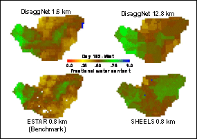


MSFC scientists have developed algorithms to enhance the spatial characteristics of remote sensing data and thus improve its usefulness in hydrologic models and other hydrologic applications. These include algorithms for disaggregating low-resolution microwave remote sensing data to the higher resolutions required by models and another to enhance the clarity of microwave data by taking advantage of the typical over-sampling performed by microwave remote sensors.
| Research Focus Areas:
Benchmark Applications:
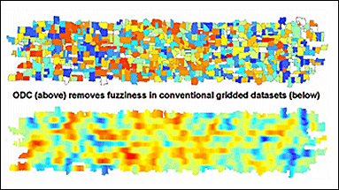
Optimal Deconvolution (ODC) uses mathematical reconstruction of sensor response functions to better characterize true microwave brightness temperature representation of features on the groung (e.g. agricultural field). |
Algorithms
Scaling Algorithms
|