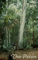
The Petén, Guatemala
Ground-Truth Information
Mayan Research challenges: collecting ground-truth information
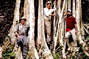 Ground-truth
information, often referred to as "reference data," involves the
collection of measurements or observations about objects, areas or phenomena
that are being remotely sensed. This ground-truth information can be used
by social scientists in two ways: first, the data can aid in the interpretation,
analysis and validation of the remotely sensed data; second, such information
helps in understanding the socioeconomic forces behind land cover modifications
due to human activities. Ground-truth
information, often referred to as "reference data," involves the
collection of measurements or observations about objects, areas or phenomena
that are being remotely sensed. This ground-truth information can be used
by social scientists in two ways: first, the data can aid in the interpretation,
analysis and validation of the remotely sensed data; second, such information
helps in understanding the socioeconomic forces behind land cover modifications
due to human activities.
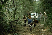 Ground-truthing is expensive and time consuming.
In recent years, the cost of computer hardware and software for remote sensing
analysis has dropped dramatically, however; the costs associated with ground-truth
activities have generally escalated. Airfare, lodging, vehicle rental, food,
labor, and the like remain expensive elements of the research activity.
However, recent advances in affordable GPS receivers and digital data field
recorders allow the researcher greater flexibility in the sampling design. Ground-truthing is expensive and time consuming.
In recent years, the cost of computer hardware and software for remote sensing
analysis has dropped dramatically, however; the costs associated with ground-truth
activities have generally escalated. Airfare, lodging, vehicle rental, food,
labor, and the like remain expensive elements of the research activity.
However, recent advances in affordable GPS receivers and digital data field
recorders allow the researcher greater flexibility in the sampling design.
 In
order to have an accurate, and sufficiently large reference data set, we
have to visit as many sites as possible in the remote and rugged terrain
of the Petén. Frequently, we break camp each day and move on to the
next location. This is in contrast to the approach used by others who remain
at a site or village for an extended period. We never excavate archeological
features, we strictly map and verify their existence. Some challenges encountered
while conducting fieldwork in the Petén include logistical problems,
communication problems, equipment failure, inadequate maps, physical stress,
suspicion, danger, and unstable political environments. Our research team
once was captured and held at gunpoint by leftist guerrillas for several
hours before being released at nightfall. In
order to have an accurate, and sufficiently large reference data set, we
have to visit as many sites as possible in the remote and rugged terrain
of the Petén. Frequently, we break camp each day and move on to the
next location. This is in contrast to the approach used by others who remain
at a site or village for an extended period. We never excavate archeological
features, we strictly map and verify their existence. Some challenges encountered
while conducting fieldwork in the Petén include logistical problems,
communication problems, equipment failure, inadequate maps, physical stress,
suspicion, danger, and unstable political environments. Our research team
once was captured and held at gunpoint by leftist guerrillas for several
hours before being released at nightfall.
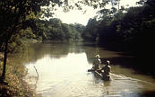 Logistics are probably the major constraint
on our fieldwork. Often we are the first professionals to visit an unrecorded
archeological site. A logistics coordinator is used to schedule in advance
the jeeps, boats, aircraft, mules, horses and workers that will get us to
our destination. Since many areas of the Petén do not have telephone
service, a member of the team who lives in Guatemala must travel weeks and
months in advance to arrange the rentals with the local villagers. The more
inaccessible the location, the more difficult the arrangements. Once the
logistics have been coordinated, the field missions last two to three weeks.
As the mode of travel switches from jeeps to boats to horses and mules,
it is critical that the dates, times, and locations for these arrangements
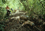
be finalized in advance. Exacerbating the logistics are the difficult conditions
sometimes encountered in the road and pathways. These conditions include
downed trees, and extremely muddy paths. Logistics are probably the major constraint
on our fieldwork. Often we are the first professionals to visit an unrecorded
archeological site. A logistics coordinator is used to schedule in advance
the jeeps, boats, aircraft, mules, horses and workers that will get us to
our destination. Since many areas of the Petén do not have telephone
service, a member of the team who lives in Guatemala must travel weeks and
months in advance to arrange the rentals with the local villagers. The more
inaccessible the location, the more difficult the arrangements. Once the
logistics have been coordinated, the field missions last two to three weeks.
As the mode of travel switches from jeeps to boats to horses and mules,
it is critical that the dates, times, and locations for these arrangements
be finalized in advance. Exacerbating the logistics are the difficult conditions
sometimes encountered in the road and pathways. These conditions include
downed trees, and extremely muddy paths.
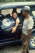 Occasionally, we are met with suspicion regarding
the true purpose of our research. We have successfully combated this situation
by taking the time to educate the local residents about our research goals
and objectives. We always take a large number of satellite images and, after
explaining how we are using the imagery, leave a copy of it with the person(s)
involved. We have gained acceptance and support for our data collection
activities, and the confidence of the inhabitants through years of exposure
and word of mouth, and are even known to the locals as the
"Traveling Wilburys,"
which came about because of the single cassette tape of
the recording artists the Traveling Wilburys that was taken on a field activity.
As the years have passed, many of the inhabitants have become sufficiently
educated about satellite imagery and GPS units, that when we stop at a village
and present the images, they can often help us interpret some of the displayed
features and anomalies. Having a Guatemalan national on our research team
has been a positive benefit to our research activities. Occasionally, we are met with suspicion regarding
the true purpose of our research. We have successfully combated this situation
by taking the time to educate the local residents about our research goals
and objectives. We always take a large number of satellite images and, after
explaining how we are using the imagery, leave a copy of it with the person(s)
involved. We have gained acceptance and support for our data collection
activities, and the confidence of the inhabitants through years of exposure
and word of mouth, and are even known to the locals as the
"Traveling Wilburys,"
which came about because of the single cassette tape of
the recording artists the Traveling Wilburys that was taken on a field activity.
As the years have passed, many of the inhabitants have become sufficiently
educated about satellite imagery and GPS units, that when we stop at a village
and present the images, they can often help us interpret some of the displayed
features and anomalies. Having a Guatemalan national on our research team
has been a positive benefit to our research activities.
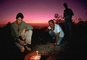 GPS measurements are a critical component of our
field research. In 1988, when there were few satellites in orbit, and the
receivers were not as sophisticated, we often found ourselves climbing a
temple at midnight to collect a position that would only be available between
1 and 4 am. Also, in the tropical rain forest, the dense vegetation cover
attenuated the GPS signals. Today, with the complete constellation of satellites,
the readings can be gathered nearly around the clock. More sophisticated
GPS receivers and software are available that allow for the collection of
more data with greater accuracy. Even with all the technology, there are
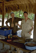
still hazards to collecting GPS information. In the tranquil scene to the
left above, what is not shown are the two jaguars which have crept onto
a tree limb above us. GPS measurements are a critical component of our
field research. In 1988, when there were few satellites in orbit, and the
receivers were not as sophisticated, we often found ourselves climbing a
temple at midnight to collect a position that would only be available between
1 and 4 am. Also, in the tropical rain forest, the dense vegetation cover
attenuated the GPS signals. Today, with the complete constellation of satellites,
the readings can be gathered nearly around the clock. More sophisticated
GPS receivers and software are available that allow for the collection of
more data with greater accuracy. Even with all the technology, there are
still hazards to collecting GPS information. In the tranquil scene to the
left above, what is not shown are the two jaguars which have crept onto
a tree limb above us.
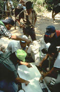 A problem often encountered is the inaccuracy of
available maps. Consistently, we find that lakes, rivers, archeological
sites, and cultural features are not located where the map indicates. Apart
from the obvious in-field confusion, there is the major concern that if
these inaccurate maps are digitized and incorporated into a GIS, they will
lead to false results for predictive models. This dilemma is resolved by
constant comparison of GPS measurements, imagery, and maps to eliminate
as much confusion as possible. Also, the names indicated on the maps are
not necessarily the same as used by the local inhabitants. A problem often encountered is the inaccuracy of
available maps. Consistently, we find that lakes, rivers, archeological
sites, and cultural features are not located where the map indicates. Apart
from the obvious in-field confusion, there is the major concern that if
these inaccurate maps are digitized and incorporated into a GIS, they will
lead to false results for predictive models. This dilemma is resolved by
constant comparison of GPS measurements, imagery, and maps to eliminate
as much confusion as possible. Also, the names indicated on the maps are
not necessarily the same as used by the local inhabitants.
 As we studied deforestation trends in the Petén
over the last several years, we designed our ground-truth activities primarily
to identify the difference between new forest clearings and regrowth. We
are now expanding our activities to include information on the decision
processes on land use and land conversion. We are in the process of interviewing
local farmers and ranchers to address the scientific issues of deforestation
rates and trends in land use conversion to understand the uncertainty involved
in modeling the terrestrial carbon budget. Through the interviews, factors
such as crop-to-fallow ratios, the decision process for converting land
to pasture or shifting to agriculture, forest fragmentation indices, spatial
characteristics of cleared land, associated socioeconomic factors will be
determined. These results will be correlated over the time scale of our
database, providing better analytical information for management decisions. As we studied deforestation trends in the Petén
over the last several years, we designed our ground-truth activities primarily
to identify the difference between new forest clearings and regrowth. We
are now expanding our activities to include information on the decision
processes on land use and land conversion. We are in the process of interviewing
local farmers and ranchers to address the scientific issues of deforestation
rates and trends in land use conversion to understand the uncertainty involved
in modeling the terrestrial carbon budget. Through the interviews, factors
such as crop-to-fallow ratios, the decision process for converting land
to pasture or shifting to agriculture, forest fragmentation indices, spatial
characteristics of cleared land, associated socioeconomic factors will be
determined. These results will be correlated over the time scale of our
database, providing better analytical information for management decisions.

Responsible Official: Dr. James L. Smoot (James.L.Smoot@nasa.gov)
Page Author: Tom Sever
Page Curator: Diane Samuelson (diane.samuelson@msfc.nasa.gov)
|
