The Petén, Guatemala
 The Petén, northern Guatemala,
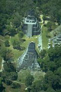
was once inhabited by a population of several million Maya before their
collapse in the 9th century A.D. The seventh and eighth centuries were a
time of crowning glory for millions of Maya; by 930 A.D. only a few scattered
houses remained. It appears that at the time of their collapse, the Maya
had cut down most of their trees. After centuries of regeneration, the Petén
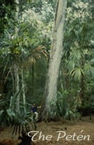
now represents the largest remaining tropical forest in Central America,
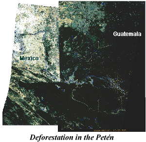
but is experiencing rapid deforestation
in the wake of an invasion of settlers. The successful adaptive techniques
of the indigenous population are being abandoned in favor of the destructive
techniques of monoculture and cattle raising. These techniques also contribute
to the destruction and looting of unrecorded archeological sites. Remote sensing and geographic information system (GIS)
analysis are being used to address issues in Maya archeology as well as
monitor the effects of increasing deforestation in the area today. One thousand
years ago the forests of the Petén were nearly destroyed by the ancient Maya, who, after centuries of
successful adaptation, finally overused their resources. Current inhabitants
are threatening to do the same thing today in a shorter time period with
a lesser population. Through the use of remote sensing / GIS analysis, we
are attempting to answer questions about the past in order to protect the
resources of the future. We cannot rely strictly on remotely sensed data, it
is necessary for the
research team to travel
into the jungle to verify what we think we see from the air. This is called
ground truthing. The Petén, northern Guatemala,
was once inhabited by a population of several million Maya before their
collapse in the 9th century A.D. The seventh and eighth centuries were a
time of crowning glory for millions of Maya; by 930 A.D. only a few scattered
houses remained. It appears that at the time of their collapse, the Maya
had cut down most of their trees. After centuries of regeneration, the Petén
now represents the largest remaining tropical forest in Central America,
but is experiencing rapid deforestation
in the wake of an invasion of settlers. The successful adaptive techniques
of the indigenous population are being abandoned in favor of the destructive
techniques of monoculture and cattle raising. These techniques also contribute
to the destruction and looting of unrecorded archeological sites. Remote sensing and geographic information system (GIS)
analysis are being used to address issues in Maya archeology as well as
monitor the effects of increasing deforestation in the area today. One thousand
years ago the forests of the Petén were nearly destroyed by the ancient Maya, who, after centuries of
successful adaptation, finally overused their resources. Current inhabitants
are threatening to do the same thing today in a shorter time period with
a lesser population. Through the use of remote sensing / GIS analysis, we
are attempting to answer questions about the past in order to protect the
resources of the future. We cannot rely strictly on remotely sensed data, it
is necessary for the
research team to travel
into the jungle to verify what we think we see from the air. This is called
ground truthing.
Central American countries have established dozens of national parks
for preservation, including the Petén. Change detection analysis,
using satellite data between 1986-1997, shows increasing deforestation of
the Petén's tropical forest as a result of an influx of settlers.
The large expanse of the forest makes it hard to monitor and protect. Satellite
imagery is proving to be a valuable tool in monitoring this area.
 The Maya Biosphere Reserve was established in
1990 through an agreement between three neighboring countries, Mexico, Guatemala,
and Belize. The reserve represents the largest contiguous tract of tropical
forest remaining in Central America. Within the boundaries of the reserve
are extensive seasonal fresh water wetlands
(bajos). The Maya Biosphere Reserve was established in
1990 through an agreement between three neighboring countries, Mexico, Guatemala,
and Belize. The reserve represents the largest contiguous tract of tropical
forest remaining in Central America. Within the boundaries of the reserve
are extensive seasonal fresh water wetlands
(bajos).
Effects of burning the rain forests:
The cleared landscape causes the thin soils to quickly erode away. The flora
and fauna are destroyed. The archeological sites are destroyed by the heat
and erosion. The cleared landscape also makes the sites more accessible
to looters.
Things seen in the Petén using Remote Sensing:
1. Different types of vegetations,
2. The pattern of deforestation,
3. Mayan roads that lead to unrecorded sites,
4. Archeological sites.
The protection of the rain forest is synonymous with the protection of archeological
sites.
Selected Papers
"Human Migration and Agricultural Expansion: An Impending Threat to the Maya
Biosphere Reserve," with S.A. Sader, C. Reining, and C. Soza.
Forestry, Volume 95, Number 12, December 1997.
"Validating Prehistoric and Current Social Phenomena Upon the Landscape of
the Peten, Guatemala," Special Publication of the National Academy of
Sciences / National Research Council on People and Pixels: Using Remotely
Sensed Data in Social Science Research, National Academy Press, May 1998.
"Time-series Tropical Forest Change Detection: a Visual and Quantitative
Approach," with S.A. Sader, and J.C. Smoot. SPIE, 2818:2-12, 1996.
"Forest Change Estimates for the Northern Peten Region of Guatemala- 1986
to 1990." In Human Ecology. September, 1994.
"Applications of Ecological Concepts and Remote Sensing Technologies in
Archeological Site Reconnaissance," with F. Miller and D. Lee. (In
Applications of Space-Age Technology in Anthropology, edited by
Clifford Behrens and Thomas Sever. NASA, Stennis Space Center, MS, 1991.)
Responsible Official: Dr. James L. Smoot (James.L.Smoot@nasa.gov)
Page Author: Tom Sever
Page Curator: Diane Samuelson (diane.samuelson@msfc.nasa.gov)
|


 The
The