
Other Links
The Petén, Guatemala Steve Sader 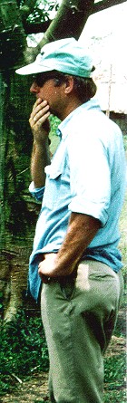 Steve Sader is a Professor of Forest
Resources and Director - Maine Image Analysis Laboratory, Dept of Forest
Management, University of Maine. He has over 20 years experience in forest
ecosystems research and remote sensing including 19 years in Central America.
He has been conducting research in northern Guatemala since 1991. His research
has involved analysis of airborne sensors including JPL's L-band SAR, LIDAR,
TIMS, TMS, CAMS, and satellite imagery directed to investigations of forest
canopy structure, biomass, species composition, and time-series forest change
monitoring. He has published extensively, and was the guest editor of a
special issue of Photogrammetric Engineering and Remote Sensing on "Remote
Sensing of Tropical Forests" published in 1990. He holds a Ph.D. in Forest
Resources Management from the University of Idaho. Steve Sader is a Professor of Forest
Resources and Director - Maine Image Analysis Laboratory, Dept of Forest
Management, University of Maine. He has over 20 years experience in forest
ecosystems research and remote sensing including 19 years in Central America.
He has been conducting research in northern Guatemala since 1991. His research
has involved analysis of airborne sensors including JPL's L-band SAR, LIDAR,
TIMS, TMS, CAMS, and satellite imagery directed to investigations of forest
canopy structure, biomass, species composition, and time-series forest change
monitoring. He has published extensively, and was the guest editor of a
special issue of Photogrammetric Engineering and Remote Sensing on "Remote
Sensing of Tropical Forests" published in 1990. He holds a Ph.D. in Forest
Resources Management from the University of Idaho.
Responsible Official: Dr. James L. Smoot (James.L.Smoot@nasa.gov)
|