ASSESSMENTS

QPE/LPW rainfall West Coast

Description:


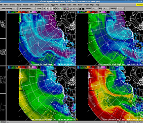
This report describes the March-April 2013 assessment of GOES-R QPE and CIRA LPW products by forecasting offices on the West Coast. GOES-R QPE is a satellite-based QPE product utilizing both geostationary IR from GOES and microwave data from several other satellites. CIRA LPW provides layered precipitable water data from MIRS retrievals near-globally. This is the first assessment for both products.

Participants: EKA, MFR, MTR
Language:
English
Publication Date: ?
Season: 1 March - 30 April 2013
Forecast Challenge: diagnosing heavy rain events
Categories: Microwave Radiometry, Geostationery Satellite

Read Assessment

Other Product Assessment Forms

Aviation and Cloud Analysis using RGB Imagery by High Latitude Forecasters

Aviation and Cloud Analysis using RGB Imagery by Southern Region WFOs

VIIRS Front Range Nighttime Imagery

View All

Assessment Reports

  • Total Lightning Assessment (view)

    15 May - 15 August 2014
  • RGB Imagery Evaluation for Aviation and Cloud Analysis (view)

    October 2014
  • UAH CI Assessment Results (ver. 3) (view)

    August 2013
  • Alaska NESDIS GOES-R QPE and CIRA LPW 2013 Assessment (view)

    June 2013
More Reports
Product Assessments
The SPoRT Center produces online surveys for several products in support of SPoRT's research and transition to operations. Surveys provide a quick and easy method for SPoRT to determine the effectiveness of the products transitioned. SPoRT prides itself on not "throwing data over the fence" by continuing to support our National Weather Service partners even after a product has been transitioned, and the surveys provide a means for interaction between SPoRT researchers and operational meteorologists. Each of the surveys below provides links to the survey itself, a summary of all surveys for a particular product, and the online training modules for the product being surveyed. View survey results.