Sea Surface Temperature (SST)
Sea Surface Temperature (SST) products are generated daily from a variety of sources. Each card on this page represents an SST product. Products on green cards, marked as "Evaluation Product," are being used by at least one National Weather Service Forecast Office. For more details on any product, click the link at the bottom of each eard. To see actual real-time data, click the link at the bottom right of the card.
For more information, see the SST Overview at the bottom of this page.
EVALUATION PRODUCT

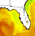
SPoRT SST Composite
A weighted blend of VIIRS, MODIS Level-2B products over a 7-day period including the most recent NESDIS and OSTIA global products.
RESEARCH

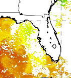
SPoRT Aqua MODIS SST Composite
An Aqua MODIS composite product that shows the weighted SST at every pixel where a retrieval could be made over the 7-day period.
SST Overview
SST data derived from satellite sensors are critical in many aspects of weather prediction and regional diagnostic studies. The satellite estimates provide SST values with comparable accuracy to buoy data but with much greater spatial coverage. As with many aspects of remove sensing of geophysical parameters, trade-offs between spatial resolution, temporal sampling, and data density compromise products and their use. Most SST estimates are derived from multichannel retrieval algorithms applied to infrared data. These approaches provide resolutions down to 1 km on a global and regional basis in the absence of clouds. Microwave estimates of SST are unaffected by non-precipitating clouds and provide a more "all weather" estimate, but suffer in spatial resolution and land contamination. Various techniques are employed to circumvent these limitations. For example, optimal interpolation techniques are applied to global AVHRR and buoy data to produce a course-resolution daily global SST product referred to at the Real-Time Gridded (RTG) analysis (Thiébaux et al. 2003). While this data set is esthetically pleasing and has global weather forecast applications, it's relatively course resolution prohibits its application to mesoscale studies on the regional scale. To address regional forecast problems by providing high resolution cloud-free SST estimates, a number of daily and multi-temporal composite SST products have been developed from both geostationary (NESDIS GOES-POES SST, e.g. Maturi et al, 2010) and polar orbiting infrared (OSTIA SST, e.g. Stark et al 2007; SPoRT MODIS-only SST, e.g. Haines et al 2007) and infrared and microwave data (SPoRT Enhanced SST, Jedlovec et al. 2010).
- Haines, S. L., G. J. Jedlovec, and S. M. Lazarus, 2007: A MODIS sea surface temperature composite for regional applications. IEEE Trans. Geosci. Remote Sens., 45, 2919-2927.
- Jedlovec, G., F. LaFontaine, J. Shafer, M. Rigney, J. Vazquez, E. Armstrong, and M. Chin, 2010: Use of high resolution SST data for operational applications. Ocean Science Workshop, Portland.
- Maturi, E. M., A. Harris, J. Mittaz, J. Sapper, R. Potash, and W. Meng, 2010: NOAA's operational geostationary and blended sea surface temperature products. Preprints 17th Conference on Satellite Meteorology and Oceanography, Annapolis, MD.
- Stark, J. D., C. J. Donlon, M. J. Martin and M.l E. McCulloch, 2007, OSTIA : An operational, high resolution, real time, global sea surface temperature analysis system., Oceans '07 IEEE Aberdeen, conference proceedings. Marine challenges: coastline to deep sea. Aberdeen, Scotland. IEEE.
- Thiébaux, J., E. Rogers, W. Wang, and B. Katz, 2003: A new high-resolution blended global sea surface temperature analysis. Bull. Amer. Meteor. Soc., 84, 645656.


