Product Assessments
The SPoRT Center produces online surveys for several products in support of SPoRT's research and transition to operations. Surveys provide a quick and easy method for SPoRT to determine the effectiveness of the products transitioned. SPoRT prides itself on not "throwing data over the fence" by continuing to support our National Weather Service partners even after a product has been transitioned, and the surveys provide a means for interaction between SPoRT researchers and operational meteorologists. Each of the surveys below provides links to the survey itself, a summary of all surveys for a particular product, and the online training modules for the product being surveyed. View survey results.
Current Assessments
ASSESSMENT
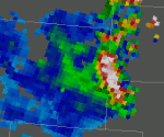
Winter 2016 NESDIS Snowfall Rate Product
Use of NESDIS Snowfall Rate Product to aid analysis of snowfall in radar-void areas to detect snowfall edges and maxima.
ASSESSMENT
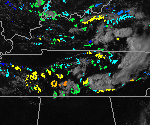
GOES-R CI Trial Period 2015
Forecasters assess the use of GOES-R CI for nowcasting convection, with an emphasis on aviation-related uses.
ASSESSMENT
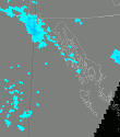
GPM, IMERG and GOES-R precipitation; NASA/LIS Soil Moisture Trial Evaluation: Summer 2015
WFO and RFC forecasters are provided several products related to the monitoring and analysis of precipitating events in data poor/void regions. Alaska and other OCONUS forecasters have large regions without radar coverage while forecasters in the Western U.S. are faced with beam blockage from topography and gaps in radar coverage. In addition, soil moisture analysis suite from the NASA/LIS is provided to help users understand the surface and sub-surface conditions in order to anticipate potential hazards from precipitation events, or the lack thereof. The Alaska summer and U.S. Southwest Monsoonal seasons were chosen for the initial trial evaluation of these products.
ASSESSMENT
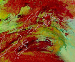
24-Hour Microphysics RGB Assessment in Alaska
In the winter of 2013/14, high-latitude users (including Alaska) assessed the use of the Nighttime Microphysics RGB imagery for Aviation and Cloud Analysis, specifically to differentiate fog from low clouds. This assessment looks to determine the value of the 24-Hour Microphysics RGB compared to last year's Nighttime Microphysics RGB.
Previous Assessments
User feedback outside current assessment periods is welcome via links below.
ASSESSMENT

NESDIS Snowfall Rate Product: CONUS Winter 2015
Use of NESDIS Snowfall Rate Product to aid analysis of snowfall in radar-void areas to detect snowfall edges and maxima.
ASSESSMENT

LIS Drought and Flood Assessment, Summer/Fall 2014
Asssement for the SPoRT Land Information System (LIS). Applications for assessing drought for the US Drought Monitor and for assessing flood potential.
ASSESSMENT

GOES-R CI Assessment
GOES-R Proxy Convective Initiation (CI) Assessment for GOES East and GOES West. Applications to aviation weather support as well as traditional spring/summer convective weather season.
ASSESSMENT
RGB Imagery Evaluation for Aviation and Cloud Analysis: Alaska/West Region
Use of RGB imagery from MODIS and VIIRS to aid analysis of cloud heights and types for aviation forecasts (TAFs) as well as fog vs low cloud delineation.
ASSESSMENT
RGB Imagery for Aviation and Cloud Analysis
Use of RGB imagery from MODIS and VIIRS to aid analysis of cloud heights and types for aviation forecasts (TAFs) as well as fog vs low cloud delineation.
ASSESSMENT
Alaska NESDIS GOES-R QPE and CIRA LPW 2013 Assessment
NESDIS GOES-R QPE and CIRA LPW products for the Alaska domain.
ASSESSMENT
CIRA Layered PW & NESDIS GOES-R QPE 2013 Assessment
CIRA Layered PW & NESDIS GOES-R QPE products.
ASSESSMENT
MODIS Fog Product
The MODIS Spectral Difference Product provides a high-resolution snapshot of fog locations.
ASSESSMENT
NESDIS Snowfall Rate Product: Alaska
Use of NESDIS Snowfall Rate Product to aid analysis of snowfall in radar-void areas to detect snowfall edges and maxima.
ASSESSMENT
Total Lightning Assessment Spring 2014 - Flash Extent & Source Densities
Applications to public safety and aviation support as well as the traditional severe weather application are evaluated with multiple user groups, from WFOs to CWSUs and National Centers.
ASSESSMENT

RGB Imagery Evaluation for Aviation and Cloud Analysis: Southern Region Coastal
Use of RGB imagery from MODIS and VIIRS to aid analysis of cloud heights and types for aviation forecasts (TAFs) as well as fog vs low cloud delineation.
ASSESSMENT

NESDIS Snowfall Rate Product: Winter 2014
Use of NESDIS Snowfall Rate Product to aid analysis of snowfall in radar-void areas to detect snowfall edges and maxima.
ASSESSMENT
VIIRS Nighttime Assessment
VIIRS nighttime products including DNB, dust, nighttime mircophysics, and LW/SW IR.
ASSESSMENT
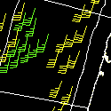
WindSat Product
WindSat Product generated from NRL data.
ASSESSMENT
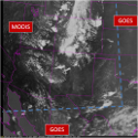
Hybrid Imagery for the GOES-R Proving Ground
Near real-time ABI proxy imagery of 11um, 3.9um, WV, and Visible using MODIS and GOES.

